Presentation
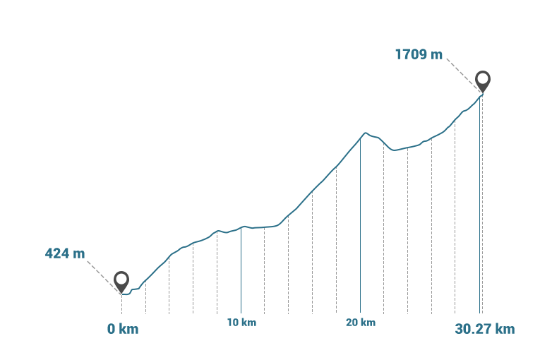
Two other giants of the Tour de France: the Aubisque pass and the Soulor pass. West slope of nearly 17km with an average slope of 7.2%, the Aubisque pass is a real challenge.
Col du Soulor: 1474 m -2nd category (from Arrens-Marsous) - average slope of 8% and maximum slope of 8.5%
Col d'Aubisque: 1709 m - 1st category (from the Soulor pass) - average slope of 6.5% and maximum slope of 9%

01:13:00

60.54 Km

1633 m

354 m

424 m

1709 m


- •
- •
- •
- •
- •
- •


