Presentation
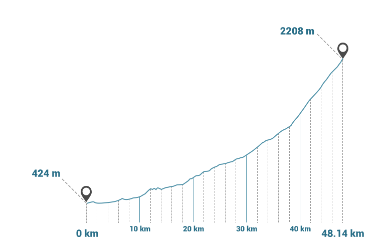
Col des Tentes (2208 m) A sporty climb in the famous Gavarnie Valley, a UNESCO World Heritage Site.
Uncategorised (from Gavarnie)
Average slope: 7.5% - max slope: 9%

01:09:00

96.28 Km

2074 m

294 m

424 m

2208 m


- •
- •
- •
- •
- •
- •


